
By Ryan Robinson, VetsWork Intern serving with the Mark Twain National Forest in Missouri.
Over the past several months, I’ve had the opportunity to serve in a unique and deeply fulfilling role by working in public land surveying and boundary marking on the Mark Twain National Forest through Mount Adams Institute’s VetsWork program. This experience has been one of personal challenge, professional growth, and deep appreciation for the natural world. I’ve spent most of my days hiking through dense woods, locating historical survey monuments, setting new ones with licensed surveyors, and helping to define the literal edges of public lands. While the work has been physically demanding, the rewards have been immense.
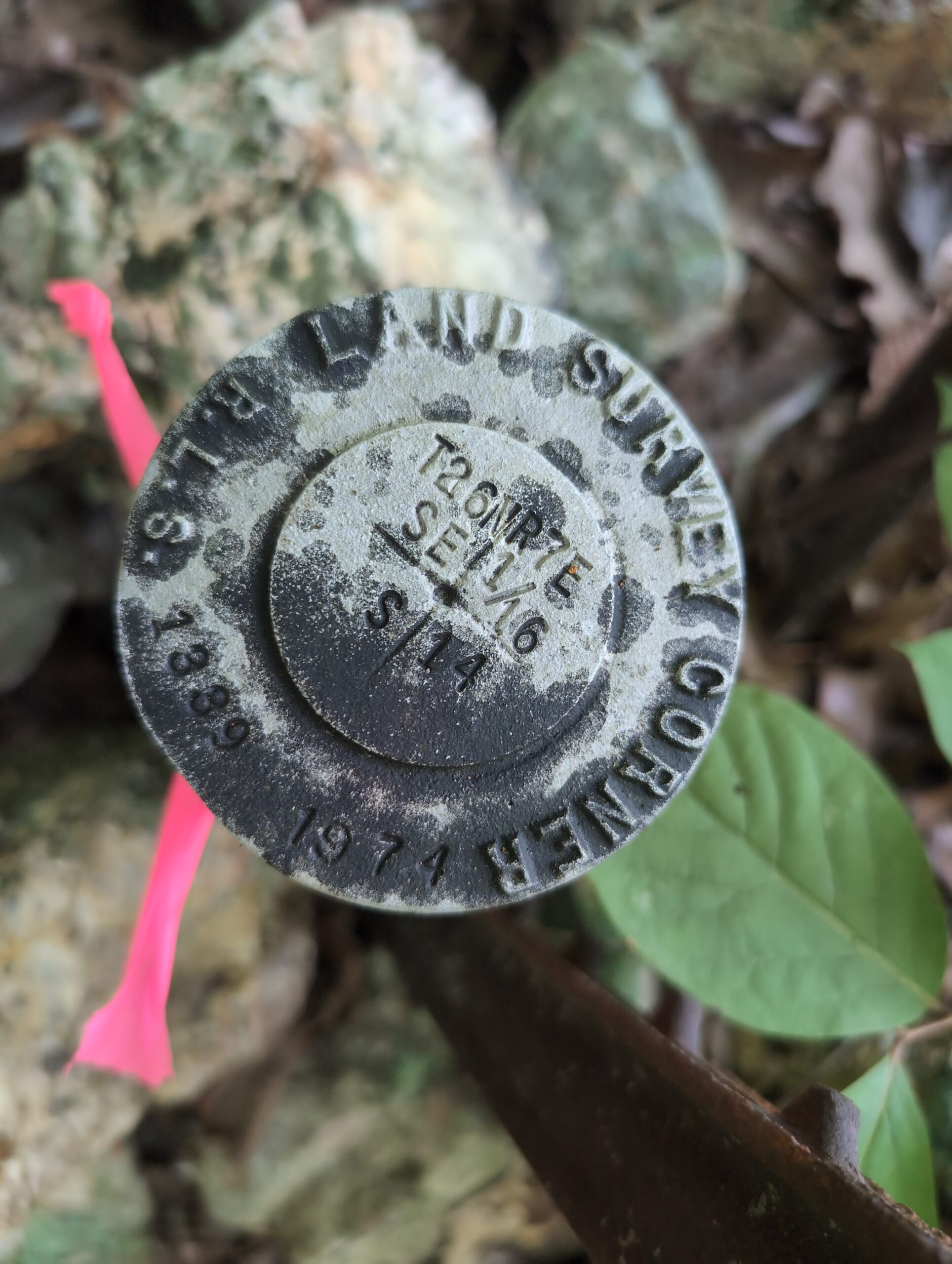
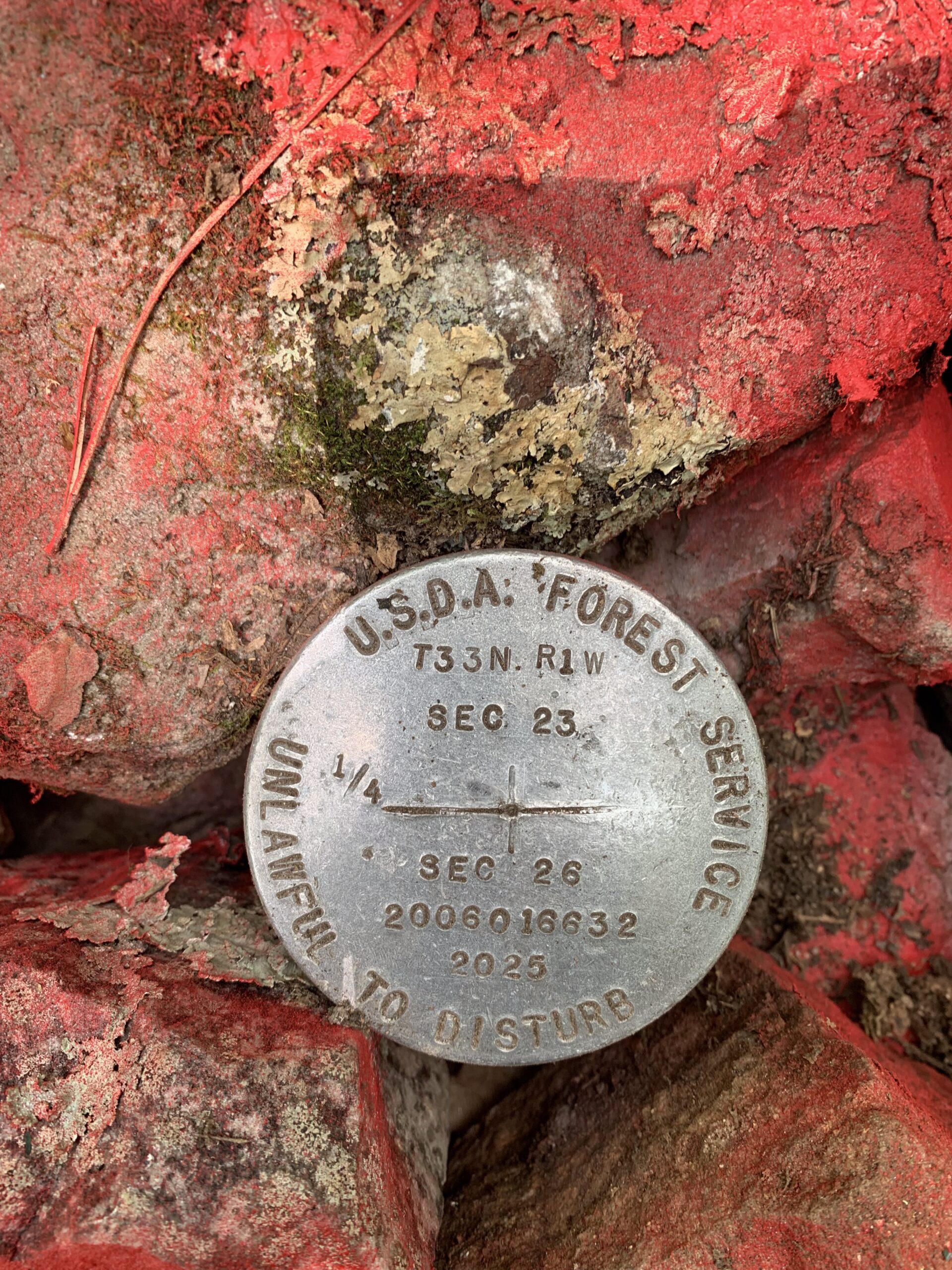
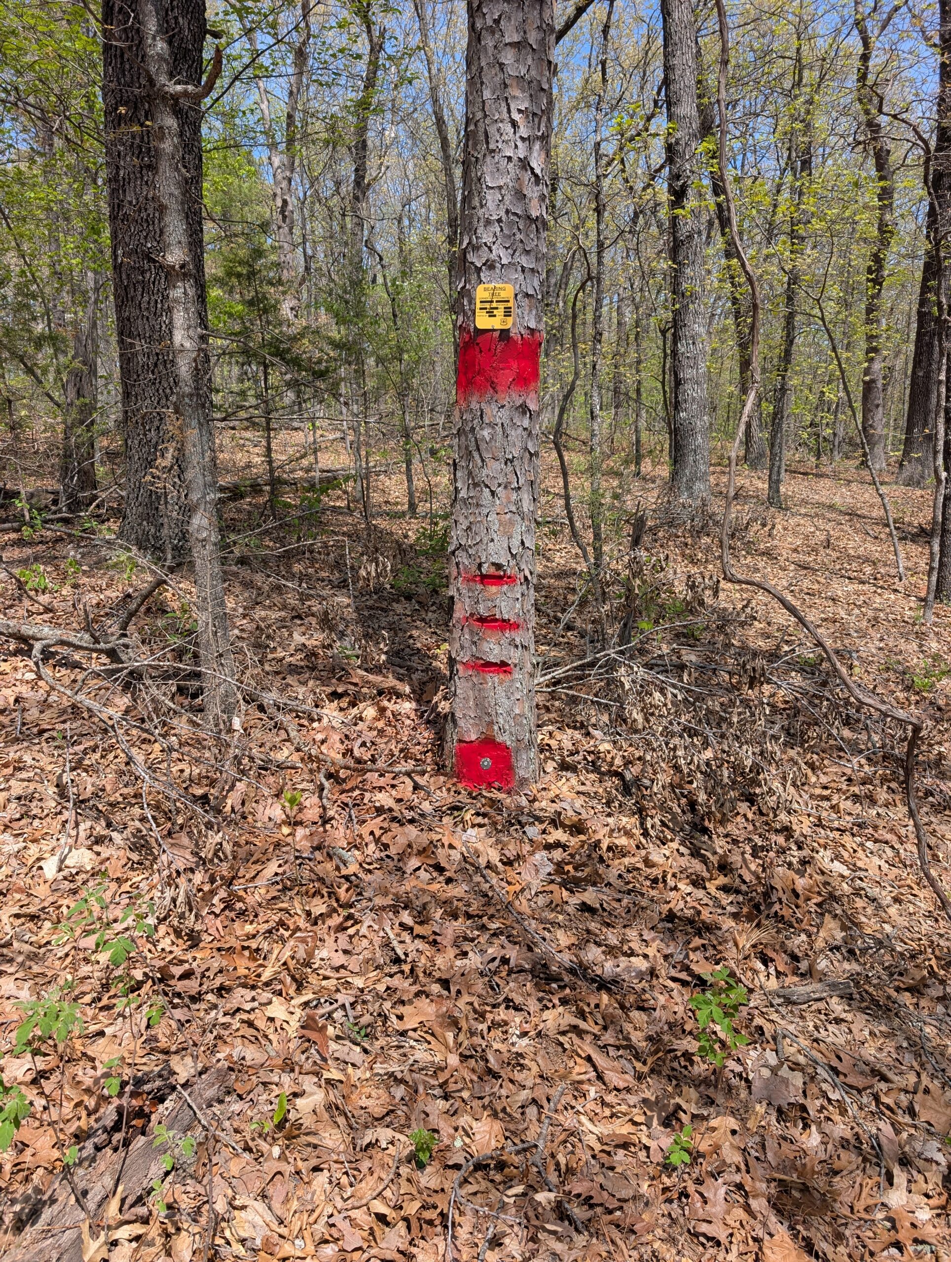
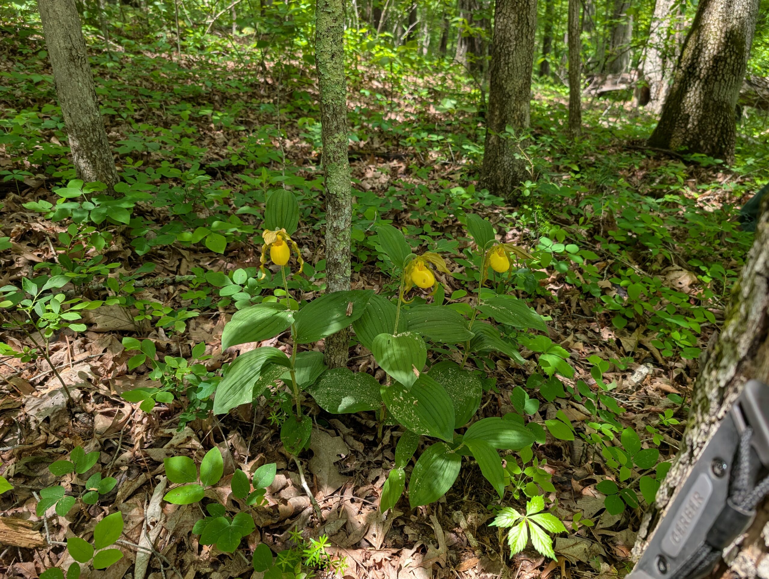
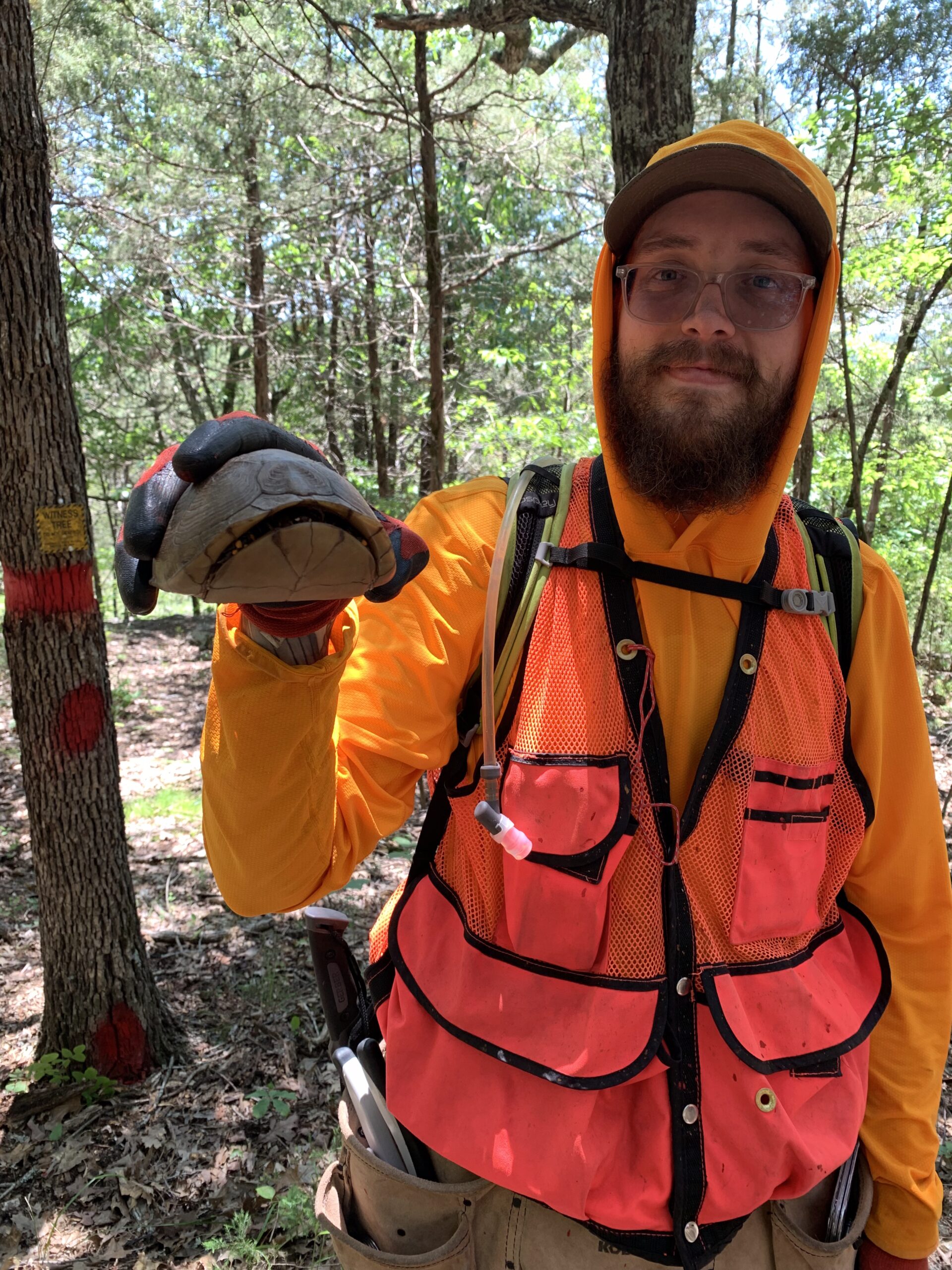
The most exciting part of my job is also the most basic: I get to work in the forest nearly every day. My office is the woods, and my commute often starts with the crunch of leaves under boots and the beep of our GPS device coming online. A typical day involves extensive hiking through sometimes steep and unforgiving terrain. My task is to find historical survey monuments, often established more than a century ago, then tie those points in with modern GPS data. After confirming these locations, I help install new boundary markers, post and refurbish Forest Service boundaries, and set new survey monuments where needed.
While this may seem like a niche task, the impact of this work is substantial. Clearly posted boundaries benefit a variety of stakeholders. They assist Forest Service Law Enforcement in addressing trespassing incidents, help Timber personnel ensure operations remain on public lands, and provide clarity to private landowners who border Forest Service property. These lines aren’t just physical dividers, they are markers of stewardship, jurisdiction, and shared responsibility. My efforts contribute to preserving the integrity of these lands and help promote cooperative land management practices across property lines.
One of the most surprising realizations from this role is how passionate the people in the natural resources field are. Despite the challenges such as limited budgets, physically demanding fieldwork, and remote working conditions, there’s a shared commitment among everyone I’ve met. Their dedication has been both inspiring and humbling. Being part of a community that values the land and its management has helped reinforce my own commitment to working in this field.

The work hasn’t been without challenges. The physical demands are intense, and some days have truly tested my limits. The toughest challenges have come from environmental conditions such as high humidity, scorching temperatures, biting insects, and difficult terrain. Completing precise and technical survey tasks while managing physical discomfort has required not just endurance, but mental toughness. Each day in the field has strengthened my physical conditioning and built my resilience. I’ve had to remain focused, adaptable, and persistent in order to complete the job well.
Professionally, I’ve learned a great deal about the science and art of land surveying. It’s a discipline that most people don’t fully understand—it’s part history, part geometry, part detective work. Reviewing survey records from as far back as the 1800s has given me a deep appreciation for how much meticulous documentation and research is involved before even setting foot in the forest. Matching these historical records with current technologies like GPS has added a layer of respect for the evolution of this essential work. The process of documenting, interpreting, and setting boundaries requires both precision and a sense of context. I’ve learned to value the unseen work that makes our public land management systems function so effectively.