
Deonza speaks to the scope of work she’s accomplished as a GIS Specialist at Tongass Misty Fjord’s Kechikan, Alaska Ranger Station.
By Deonza Mohamed
I have been working as a GIS Specialist for the Tongass Misty Fjord’s Ketchikan AK Ranger Station since March 4, 2024, to present.
So far, I have completed seven projects for clients:
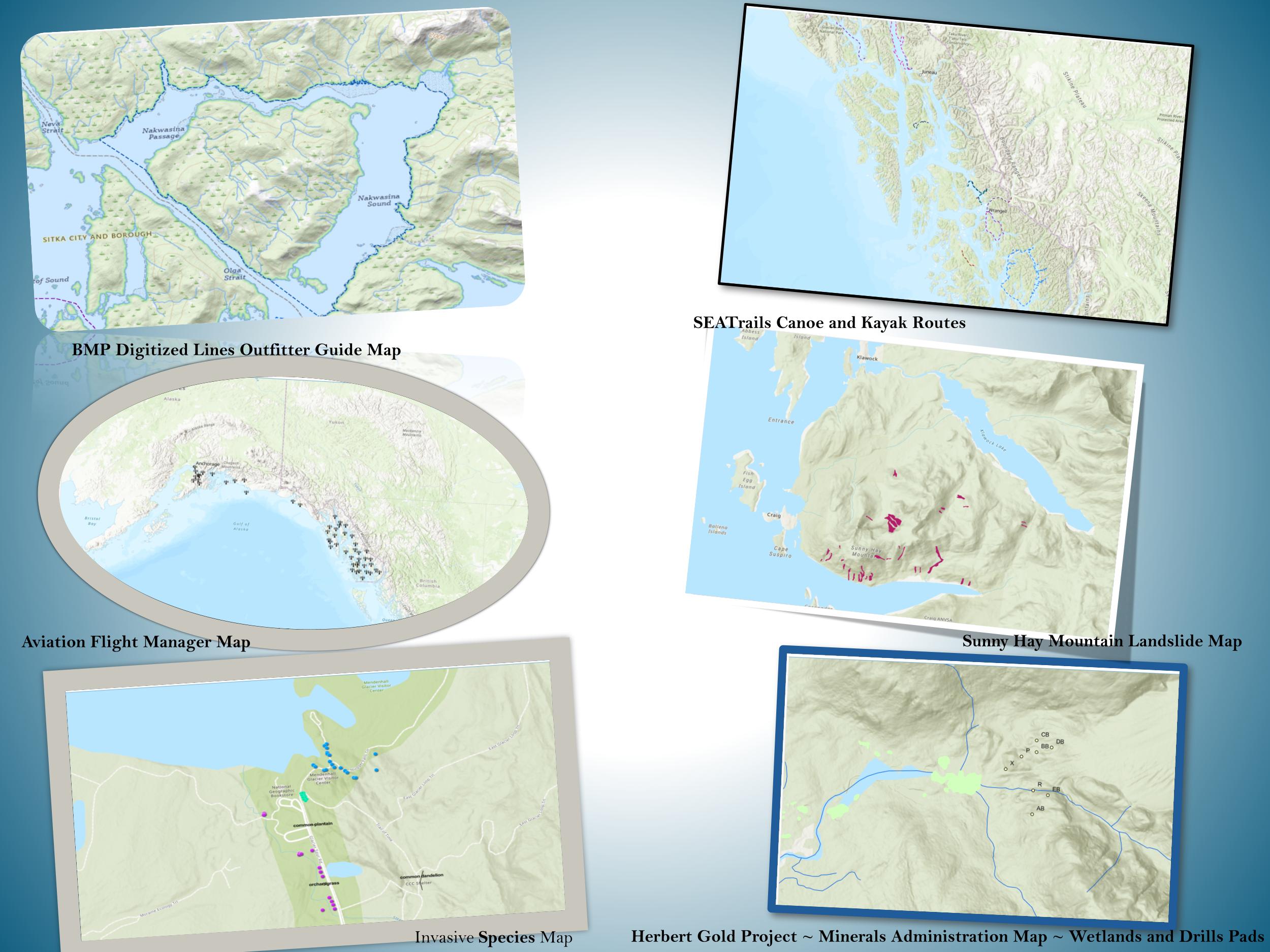
- My first project was creating a Digitized Lines Map for the SeaTrails Canoe and Kayak Routes. This map is intended to be used for leisure activities in the Tongass AK Region. I made this map for one of the GIS Team members in my shop.
- My next project was an Aviation Flight Manager map. I was originally supposed to create the map for the Tongass Dispatch Unit, but a map was imported from the CIO Office instead. I took the leisure to create the map for possible future use for the Tongass AK Region.
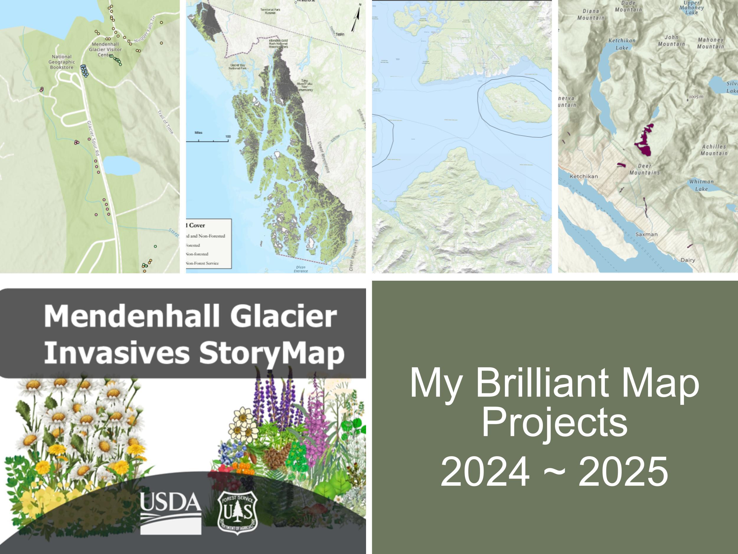
- Another map project that is in progress is the Invasive Species Map for the Juneau AK Mendenhall Lake/Visitor Center. It consists of two types of invasive species: Ranunculus and Oxeye Daisy. The goal is to create a story map that will be used for public education. The story map looks awesome, and I work with a good team virtually. Hopefully, we can get it published before my departure.
- I was working on a landslide’s partnership map with the GIS supervisor on the GIS team. The focus was Sunny Hay Mountain near Craig, AK. The map was constructed by uploading over 620 coordinates and creating polygon features that display a near exact replica of all landslides recorded in the US Geological Survey website landslide inventory dating back to ~1948 to 2001. I decided to create this map to specifically focus on the area for the Tongass District to use for a possible future landslide susceptibility analysis.
- I recreated a Herbert Gold Project map layout for the Tongass Minerals Administration Division displaying drill pad sites and wetland inventory for a future drilling project in the Tongass AK Region.
- My most recent map project was a BMP (Best Management Practices) Outfitter Guide Map for the Special Uses Division in the Tongass AK Region. The map consists of 42 areas for navigation for permit workers outside of the US Forest Service. I created a map series of layouts for all 42 areas and created an Avenza Map with one of the GIS Team members in my shop. This map is to be used for real-time navigation. The BMP maps turned out awesome! It was the biggest project I had here. I did all the digitizing for navigation areas in ArcGIS Pro, and that took quite a while, but I made it through! My colleague put a lot of hard work and effort into making the Avenza maps.
- I also completed a narrative map for Forested & Non-Forested Carbon Analysis with help from my colleague.
During my internship I also completed two certified courses: Spatial Data Science: The New Frontier in Analytics (6-week course) & Make an Impact with Modern Geo Apps (4-week course). These were great courses!
I also enjoyed working in ArcGIS Pro and ESRI online, doing narrative maps and a story map, and learning geoprocessing tools. I also completed college courses during my time here.
In terms of what the future holds, I have been getting referred for jobs and getting interviews, and I was recently offered a position as a GIS Specialist. This internship has given me a lot of independence, autonomy, and flexibility, and hands on experience. I am a lifelong learner and can work independently, so I had very little help with GIS training here, and I was able to create maps on my own, with critiques, of course, as with any project.
I am so glad I found MAI and that I had this opportunity to work for this organization, and I am glad this service is provided to veterans. I feel more ready than ever to take on any role in the real world! Thanks so much for everything! John 3:3-5